On November 9th, the 2026 Cultural Technology Industry Development Forum, themed "Technology Advancing, Culture Innovating," opened in Changsha, Hunan. During the main forum, Science and Technology Daily released the "Cases of the Integration of Culture and Technology in 2026," in which Nanjing University's "One City, Five Maps: Digital Mapping to Safeguard Ancient Chinese Cities" was selected as one of the Top Ten Exemplary Cases.
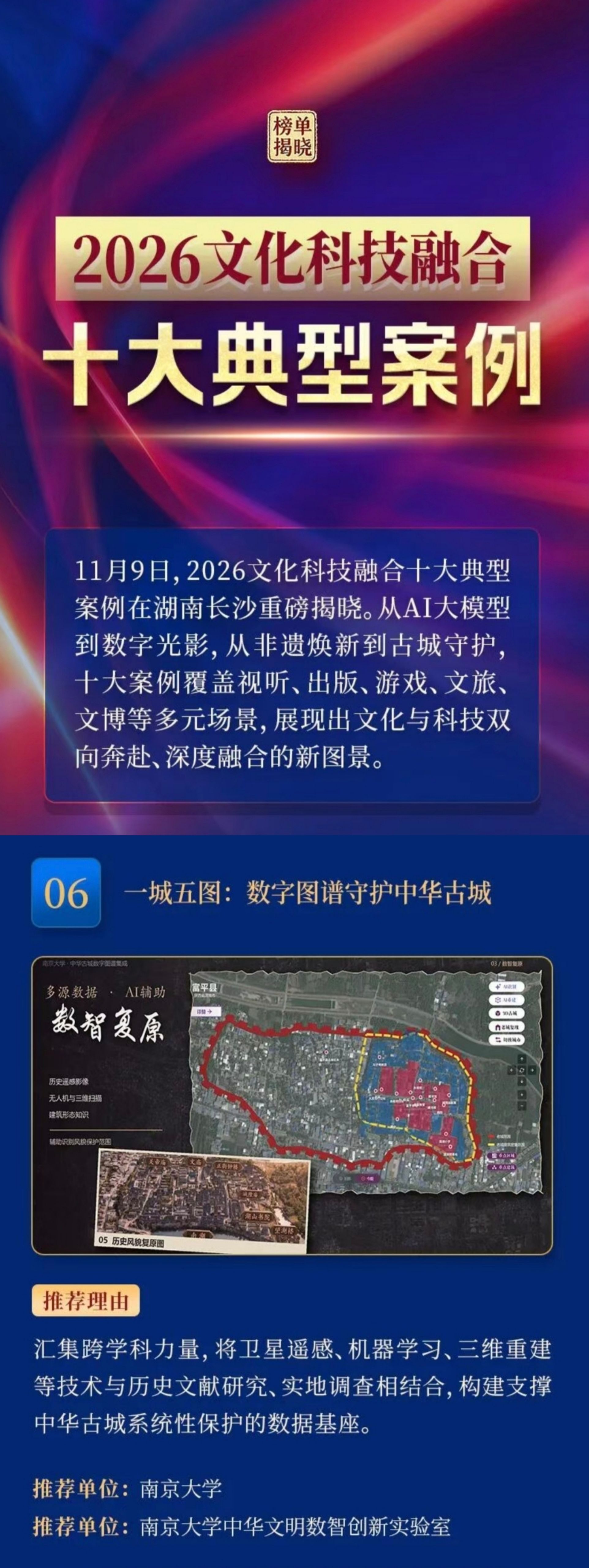
One City, Five Maps: Digital Mapping to Safeguard Ancient Chinese Cities

The "One City, Five Maps" project centers on the digital protection of ancient Chinese cities, focusing on resolving issues such as the difficulty in identifying protection targets after changes in the historical patterns of ancient cities, the lack of professional and technical resources for grassroots ancient city protection, and the poor connection between spatial data and cultural interpretation of ancient Chinese cities.
The project brings together interdisciplinary forces, combining satellite remote sensing, machine learning, 3D reconstruction, and more with historical document research and field surveys. It conducts the compilation of comparative maps of ancient and modern times, assists in judging the scope of landscape protection, digitally restores historical landscapes, and integrates cultural data of ancient cities, building a data foundation for the systematic protection of ancient Chinese cities, providing intelligent support for the protection and inheritance of cultural heritage and the research of ancient Chinese city systems.
The "One City, Five Maps" team uses machine learning to assist in identifying the scope of landscape protection, contrasts current data obtained by drone oblique photography and 3D laser scanning with historical remote sensing images, and utilizes AI-assisted generation technology to digitally restore ancient city architectural layouts and historical landscapes, forming digital assets available for heritage research and digital display verification.
Relying on more than 4,000 volumes and over 40,000 books of ancient local chronicles in Nanjing University Library, the "One City, Five Maps" project team launched the compilation of the "Comprehensive Series of Digital Mapping of Ancient Chinese Cities," completing the selection and scanning of 1,035 local chronicles from Jiangsu, Henan, Shaanxi, and Fujian provinces. Simultaneously, they are organizing the writing of the "History of the Ancient Chinese City System" to deepen research on the ancient Chinese city system and its cultural connotations, providing a documentary foundation and academic support for the content construction of the "Chinese Urban Civilization" intelligent platform, enriching the historical basis and local characteristics for digital exhibitions and cultural tourism content development.
As of now, the "One City, Five Maps" team, based on the historical satellite image atlas of more than 2,800 old cities nationwide, has completed the compilation of the "National Historical Satellite Image Atlas of Ancient Prefecture and County Cities and Important Military Town Sites of the Ming and Qing Dynasties." They have also completed the digital mapping of old cities for 1,967 county-level administrative districts nationwide, compiling over 7,000 thematic maps.
About "Cases of the Integration of Culture and Technology in 2026"
Science and Technology Daily released the "Cases of the Integration of Culture and Technology in 2026," including 10 typical cases and 20 innovative cases, covering directions such as AIGC audio-visual creation, large model activation of regional contexts, intangible cultural heritage digital protection, intelligent restoration of cultural relics, immersive cultural tourism, and AI co-creation of music and opera. They provide replicable and referential experiences for regions promoting cultural technology integration.